
The city of Sheridan has experienced its share of zoning issues in recent years mainly because of rapid growth in housing development and businesses.
As Sheridan transitions into more of a bedroom community to the Little Rock metro area and loses some of its rural roots, city leaders decided earlier this year its zoning map needed updated.
At Tuesday night's city council meeting, Mayor Cain Nattin discussed the zoning map and how citizens can soon view the new map.
The Reckoning reached out to Nattin for some clarification on the new map.
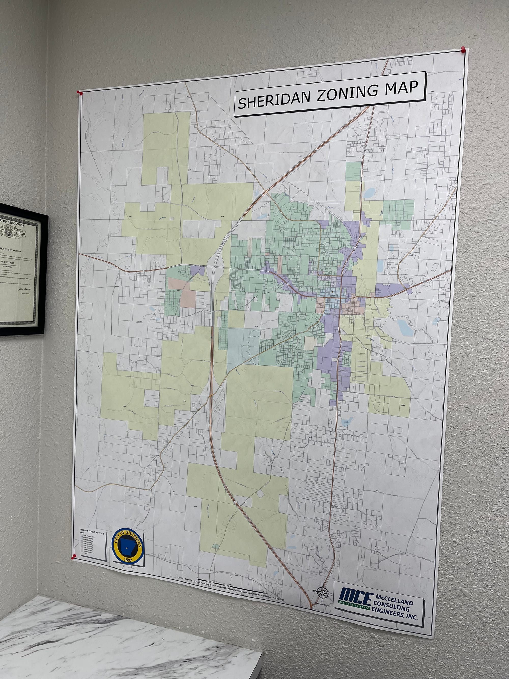
"Sheridan’s zoning map was originally created in 1968, and the only copy of the city had been a deteriorated paper map that had been marked with pencils and pens for decades," Nattin said. "Earlier this year, the City Council approved having a clean, accurate digital version created, so property owners and staff could actually read it and use it."
(See the original map in the photo at the top of this story.)
If citizens are worried their zoning classification has changed, a review period will start next week at Sheridan City Hall.
"We plan to have a review period at City Hall starting Dec. 8th - 19th during office hours to allow citizens to check their property and if they have any issues, they can start the process with my office to change the map, but only if they have documented proof the zone showed is in fact a different zone," Nattin wrote in his email to the Reckoning. "I don't think we will have any problems, hopefully. The new map will be on the City of Sheridan mobile app and the upcoming new website!"
"There hasn’t been an ordinance passed to change the zoning map itself," Nattin said. "The map simply reflects the zoning classifications already adopted in ordinance."
The city hired McClelland Consultant Engineering in Little Rock for the project. Nattin said the firm has worked on projects and designs for Sheridan for more than 10 years.
"I reached out to Max Hicks, an engineer at McClelland about mid 2024 to reprint our zoning map," Nattin said. "I met with him and previous Mayor Joe Wise to bring it up to date, since Mayor Wise had forgotten more about Sheridan zoning than I will probably ever know!"
Nattin said that Hicks and Wise finished the map before Wise passed away in November 2024. Wise served as Sheridan's mayor from 1988 until 2022 when he retired.
"I'm very appreciative of McClelland for the work as well as Mayor Wise," Nattin said. "I was very supportive of this effort due to the fact that this allows for a more transparent publishing of city documentation, as well as allowing online access to vital information for citizens, developers, real estate agencies, etc."
Nattin told the Reckoning the city paid McClelland $14,053.75 for the new zoning map.
The city has launched the map on its mobile app, too.
On the app, a viewer can see who owns a property parcel in town – much like the Onyx app used by hunters and real estate agents.
Nattin is making strong strides in bringing Grant County into the 21st century.
"Moving to a modern digital zoning map finally brings Sheridan into the 21st century," Nattin told the Reckoning. "It replaces a faded, handwritten late 1960s map with something clear, accurate, and easy for every resident to understand. This is about transparency, accessibility, and giving people the tools they deserve to see how their city is zoned."


